Services
Surveying & Engineering Services in North Wales
At Gora Geomatics, we provide accurate, reliable and professional surveying, engineering and modelling services across North Wales and the North West of England. Our team brings over 40 years of experience delivering high-quality data for planning, design, construction and earthworks.
We support contractors, developers, engineers and designers with fast turnaround times, precise measurements and dependable results — no matter the size of the project.
services
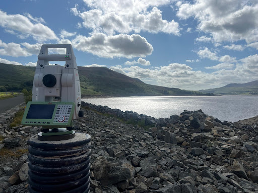
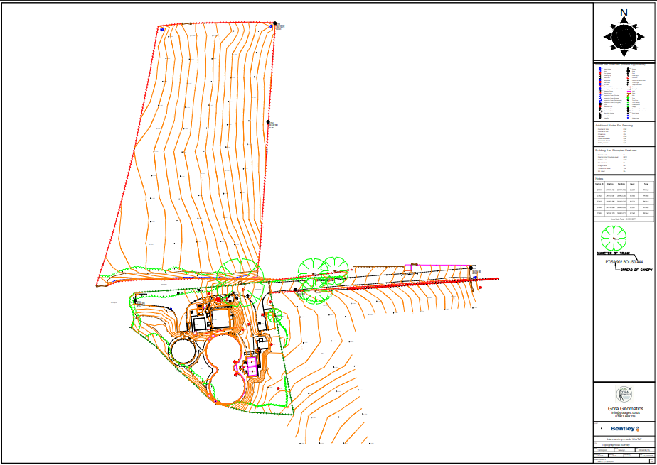
Land & Topographical Surveys
Accurate site surveys for planning, design and development
Topographical and land surveys provide detailed site data including levels, boundaries, features, utilities and structures. We tailor every survey to your project requirements, producing clear, high-quality drawings for architects, engineers and planners.
Includes:
Land surveying
Topographical surveys
Measured building surveys
GPS/GNSS surveys
3D laser scanning
Construction and engineering surveys
services
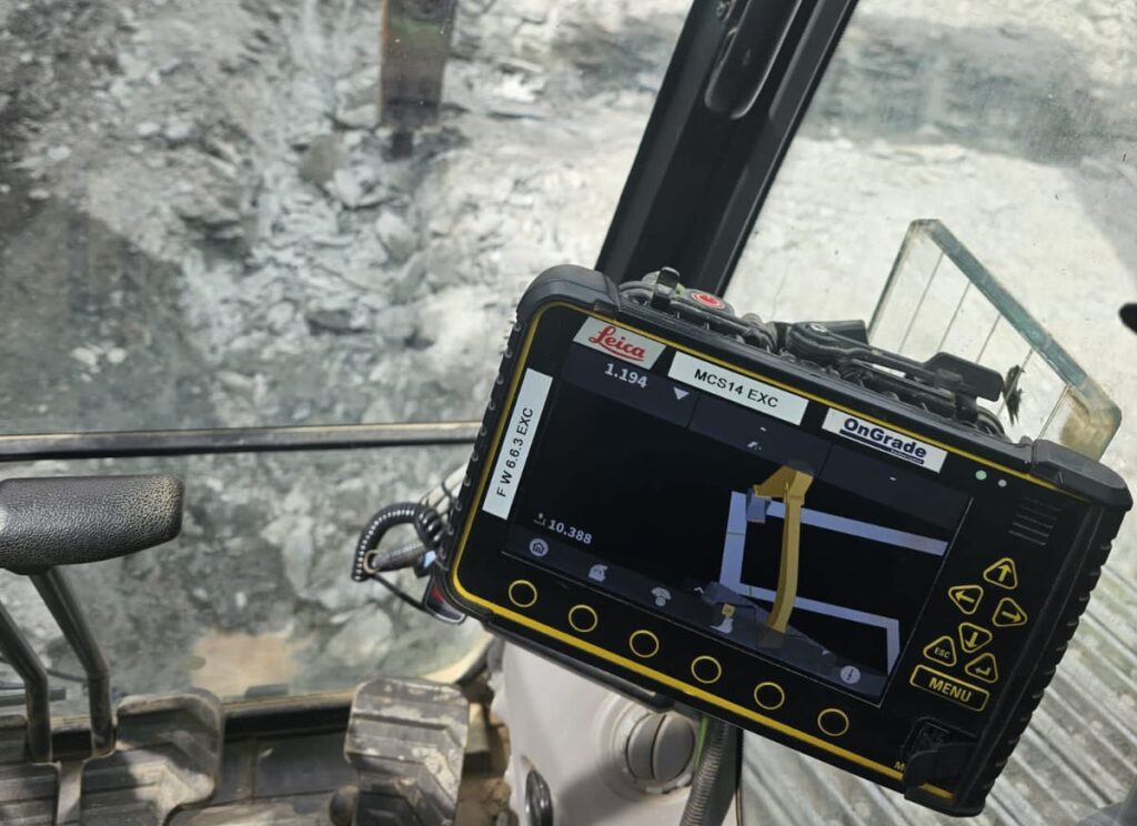
Machine Control & Digital Terrain Modelling (DTM)
With years of experience preparing accurate Digital Terrain Models (DTMs) for machine control, we help construction teams work smarter and safer. Machine control uses GNSS, total stations, and 3D models to guide plant machinery with precision—ideal for earthworks, roadworks, drainage and infrastructure projects.
We create machine control models based on your drawings and tailored to your equipment format (Trimble, Leica, Topcon etc.). We can also work directly with your designer to ensure the data is fully compatible and ready to use on site.
Applications include:
Bulk excavation & filling
Road & hardstanding trimming
Drainage excavation
Service avoidance (above & below ground)
services
Site Setting Out
With over 40 years of combined experience, we deliver accurate and dependable site setting out for projects of any size—from small housing plots to major infrastructure such as hospitals, highways and marine structures.
Our engineers have successfully delivered on complex schemes including 8 km dual carriageways and projects with over 1,400 bolt clusters. Using the latest GNSS and robotic total stations, we provide fast, precise and efficient setting out that keeps your project progressing smoothly.
By working directly with design teams, we ensure all digital data is received, checked and processed correctly—reducing on-site calculations, minimising errors, and improving workflow.
services
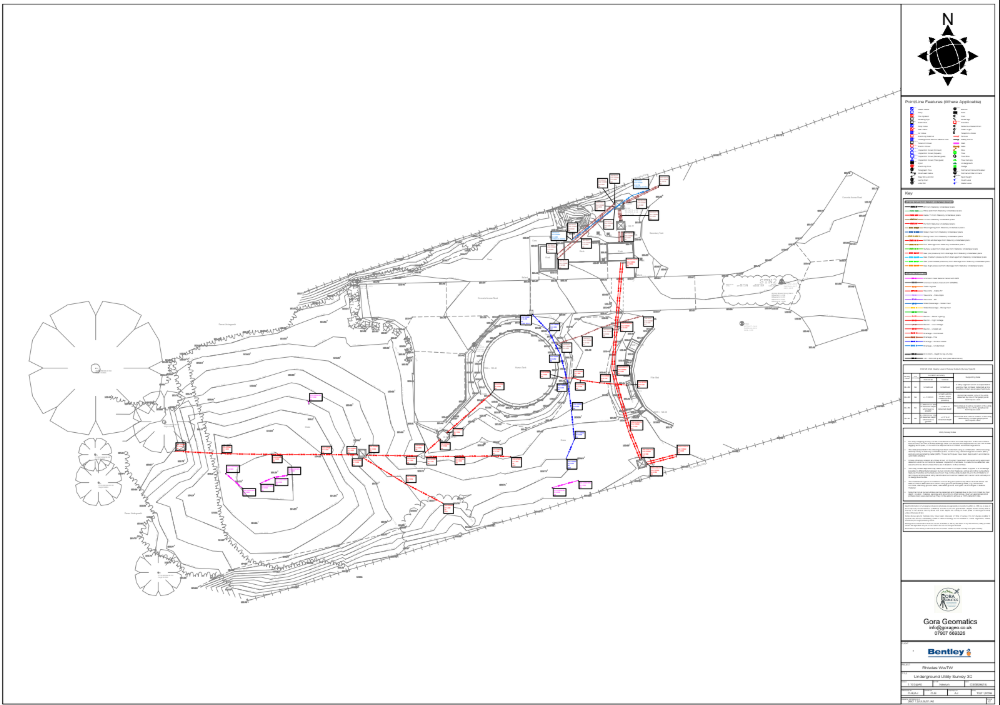
PAS 128 Utility Surveys & GPR
We deliver PAS 128-compliant utility surveys using Ground Penetrating Radar (GPR) and modern detection tools to locate and map underground services with confidence. This reduces risk, prevents clashes, and ensures excavation works remain safe, efficient and fully informed.
Whether you’re in early design, feasibility studies or preparing to dig, we provide the clarity and data you need.
What we offer:
High-resolution detection of known & unknown utilities
On-site colour-coded service markings
Digitised, georeferenced outputs for CAD & BIM integration
Full compliance with the latest PAS 128 standards
services
Volume & Quantity Surveys
Accurate volume measurement is essential for cost control, tendering and efficient delivery. Whether it’s cut-and-fill, stockpiles or bulk earthworks, we provide dependable data to keep your project on track.
We use advanced methods such as 3D laser scanning, drone photogrammetry, GNSS and total stations to calculate volumes with accuracy and consistency.
Our services include:
Cut & fill calculations
Stockpile assessments
Excavation & backfill measurement
Site regrading & earthmoving support