
Land & Topographical Surveys
Volume & Quantity Surveys in North Wales
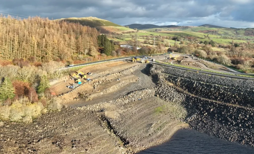
We provide accurate volume and quantity surveys across North Wales and the North West of England, supporting earthworks planning, cost control and efficient project delivery.
Our surveys deliver reliable data for cut and fill calculations, stockpiles, excavation and bulk earthworks, helping contractors and developers make informed decisions.
Accurate Earthworks Volume Calculations
Precise volume measurement is critical for managing costs, programming works and avoiding disputes. Our surveys provide clear, dependable quantities for:
Cut and fill earthworks
Stockpile volumes
Excavation and backfill
Site regrading
Material movement planning
We ensure volumes are calculated consistently and accurately using proven survey methods.
Survey Methods We Use
We use the most appropriate technology for each site to ensure accuracy and efficiency, including:
GNSS surveying
Robotic total stations
3D laser scanning
Drone photogrammetry (where appropriate)
Digital terrain modelling (DTM)
By combining these techniques, we capture reliable ground data across both small and large-scale sites.
Supporting Cost Control & Planning
Accurate quantity data helps you:
Control earthworks costs
by providing accurate volume data that supports budgeting and cost management throughout the project lifecycle.
Track progress against programme
using repeat surveys to measure completed works and compare progress against planned quantities.
Verify contractor quantities
with independent survey data to confirm earthworks volumes and reduce commercial disputes.
Reduce material over-ordering
by using reliable quantity calculations to better plan material movements and deliveries.
Support valuations and claims
with defensible survey data suitable for interim valuations, final accounts and contractual reporting.
Provide independent, auditable data to support commercial and contractual decisions
that supports commercial decisions and offers confidence to clients, engineers and project teams.
Digital Outputs & Deliverables
We supply clear, practical outputs tailored to your workflow, including:
Cut and fill reports
Stockpile volume calculations
Digital terrain models (DTMs)
CAD-compatible drawings
Machine control-ready data
All data can be integrated with design, planning and construction systems.
Applications
Our volume and quantity surveys are commonly used for:
Bulk earthworks projects
Infrastructure and highways
Quarries and aggregates
Housing developments
Commercial and industrial sites
From early planning to final verification, we support the full project lifecycle.
All Services
Land & Topographical Surveys
Accurate site surveys providing detailed level and feature data to support planning, design and construction.
Machine Control & Digital Terrain Modelling
3D terrain models and machine control data to improve accuracy, efficiency and productivity on site.
Site Setting Out
Precise engineering setting out to ensure construction works are built exactly to design.
PAS 128 Utility Surveys & GPR
Underground utility detection surveys to reduce risk and support safe excavation and design.
Volume & Quantity Surveys
Reliable earthworks volume calculations for cost control, planning and progress tracking.
Get a Quote
If you need reliable surveying or engineering support for your project, get in touch with our team today.
We provide clear advice, accurate data and fast turnaround across North Wales and the North West of England.